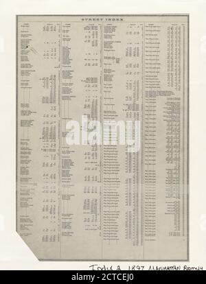
 Street Index (2), Hudson Street - York Street., cartographie, cartes, 1897, Bromley, George Washington, Bromley, Walter Scott Banque D'Imageshttps://www.alamyimages.fr/image-license-details/?v=1https://www.alamyimages.fr/street-index-2-hudson-street-york-street-cartographie-cartes-1897-bromley-george-washington-bromley-walter-scott-image376444376.html
RM2CTCEJ0–Street Index (2), Hudson Street - York Street., cartographie, cartes, 1897, Bromley, George Washington, Bromley, Walter Scott
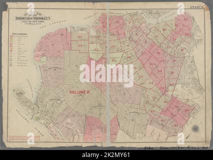 Bromley, George Washington. Cartographie, cartes, cartes d'index. 1908. Lionel Pincus et Princess Firyal Map Division. Brooklyn (New York, New York) , Index des cartes: Brooklyn (Bromely) , vol. 1 Banque D'Imageshttps://www.alamyimages.fr/image-license-details/?v=1https://www.alamyimages.fr/bromley-george-washington-cartographie-cartes-cartes-d-index-1908-lionel-pincus-et-princess-firyal-map-division-brooklyn-new-york-new-york-index-des-cartes-brooklyn-bromely-vol-1-image483579993.html
RM2K2MY61–Bromley, George Washington. Cartographie, cartes, cartes d'index. 1908. Lionel Pincus et Princess Firyal Map Division. Brooklyn (New York, New York) , Index des cartes: Brooklyn (Bromely) , vol. 1
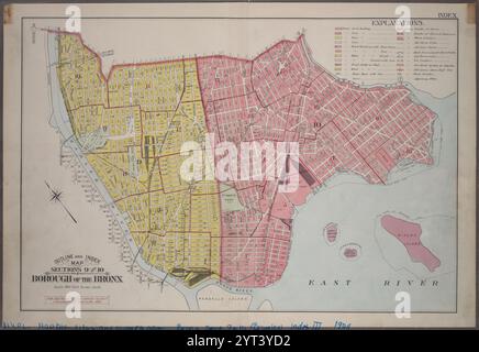 Plan et index, sections 9 et 10, arrondissement du Bronx. 1904 par Bromley, George Washington Banque D'Imageshttps://www.alamyimages.fr/image-license-details/?v=1https://www.alamyimages.fr/plan-et-index-sections-9-et-10-arrondissement-du-bronx-1904-par-bromley-george-washington-image634412382.html
RM2YT3YD2–Plan et index, sections 9 et 10, arrondissement du Bronx. 1904 par Bromley, George Washington
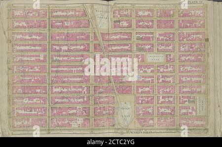 Plaque 14 carte délimitée par W. 25th St., 2nd Ave., E. 14th St., 7th Ave., cartographie, cartes, 1891, Bromley, George Washington, Bromley, Walter Scott Banque D'Imageshttps://www.alamyimages.fr/image-license-details/?v=1https://www.alamyimages.fr/plaque-14-carte-delimitee-par-w-25th-st-2nd-ave-e-14th-st-7th-ave-cartographie-cartes-1891-bromley-george-washington-bromley-walter-scott-image376435236.html
RM2CTC2YG–Plaque 14 carte délimitée par W. 25th St., 2nd Ave., E. 14th St., 7th Ave., cartographie, cartes, 1891, Bromley, George Washington, Bromley, Walter Scott
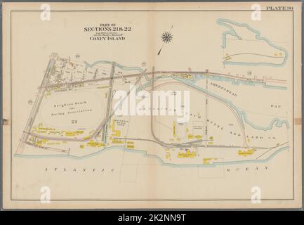 Bromley, George Washington. Cartographie, cartes, atlas, levés de terrain. 1907. Lionel Pincus et Princess Firyal Map Division. Brooklyn (New York, New York) , Plaque 30 de cartes: Coney Island plaque 30 Banque D'Imageshttps://www.alamyimages.fr/image-license-details/?v=1https://www.alamyimages.fr/bromley-george-washington-cartographie-cartes-atlas-leves-de-terrain-1907-lionel-pincus-et-princess-firyal-map-division-brooklyn-new-york-new-york-plaque-30-de-cartes-coney-island-plaque-30-image483597348.html
RM2K2NN9T–Bromley, George Washington. Cartographie, cartes, atlas, levés de terrain. 1907. Lionel Pincus et Princess Firyal Map Division. Brooklyn (New York, New York) , Plaque 30 de cartes: Coney Island plaque 30
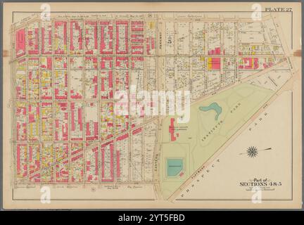 Délimitée par Bedford Avenue, Malbone Street, (Prospect Park) Flatbush Avenue, Eastern Parkway, Underhill Avenue et Atlantic Avenue, plaque 27 1908 par Bromley, George Washington Banque D'Imageshttps://www.alamyimages.fr/image-license-details/?v=1https://www.alamyimages.fr/delimitee-par-bedford-avenue-malbone-street-prospect-park-flatbush-avenue-eastern-parkway-underhill-avenue-et-atlantic-avenue-plaque-27-1908-par-bromley-george-washington-image634446833.html
RM2YT5FBD–Délimitée par Bedford Avenue, Malbone Street, (Prospect Park) Flatbush Avenue, Eastern Parkway, Underhill Avenue et Atlantic Avenue, plaque 27 1908 par Bromley, George Washington
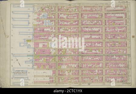 Plaque 19 carte délimitée par W. 47th St., 8th Ave., W. 36th St., Hudson River, cartographie, cartes, 1891, Bromley, George Washington, Bromley, Walter Scott Banque D'Imageshttps://www.alamyimages.fr/image-license-details/?v=1https://www.alamyimages.fr/plaque-19-carte-delimitee-par-w-47th-st-8th-ave-w-36th-st-hudson-river-cartographie-cartes-1891-bromley-george-washington-bromley-walter-scott-image376434462.html
RM2CTC1YX–Plaque 19 carte délimitée par W. 47th St., 8th Ave., W. 36th St., Hudson River, cartographie, cartes, 1891, Bromley, George Washington, Bromley, Walter Scott
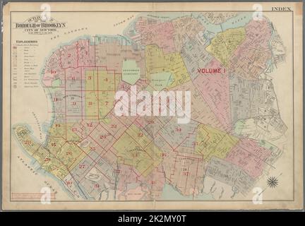 Bromley, George Washington. Cartographie, cartes, cartes d'index. 1907. Lionel Pincus et Princess Firyal Map Division. Brooklyn (New York, New York) , Cartes carte de l'arrondissement de Brooklyn, Index de la ville de New York Banque D'Imageshttps://www.alamyimages.fr/image-license-details/?v=1https://www.alamyimages.fr/bromley-george-washington-cartographie-cartes-cartes-d-index-1907-lionel-pincus-et-princess-firyal-map-division-brooklyn-new-york-new-york-cartes-carte-de-l-arrondissement-de-brooklyn-index-de-la-ville-de-new-york-image483579848.html
RM2K2MY0T–Bromley, George Washington. Cartographie, cartes, cartes d'index. 1907. Lionel Pincus et Princess Firyal Map Division. Brooklyn (New York, New York) , Cartes carte de l'arrondissement de Brooklyn, Index de la ville de New York
![Plaque 35, partie du quartier 5 [carte reliée par Sleight Ave, Rockaway St, Surf Ave, Bulkhead Line, Amboy Road] 1917 par Bromley, George Washington Banque D'Images Plaque 35, partie du quartier 5 [carte reliée par Sleight Ave, Rockaway St, Surf Ave, Bulkhead Line, Amboy Road] 1917 par Bromley, George Washington Banque D'Images](https://l450v.alamy.com/450vfr/2yt3ygg/plaque-35-partie-du-quartier-5-carte-reliee-par-sleight-ave-rockaway-st-surf-ave-bulkhead-line-amboy-road-1917-par-bromley-george-washington-2yt3ygg.jpg) Plaque 35, partie du quartier 5 [carte reliée par Sleight Ave, Rockaway St, Surf Ave, Bulkhead Line, Amboy Road] 1917 par Bromley, George Washington Banque D'Imageshttps://www.alamyimages.fr/image-license-details/?v=1https://www.alamyimages.fr/plaque-35-partie-du-quartier-5-carte-reliee-par-sleight-ave-rockaway-st-surf-ave-bulkhead-line-amboy-road-1917-par-bromley-george-washington-image634412480.html
Plaque 35, partie du quartier 5 [carte reliée par Sleight Ave, Rockaway St, Surf Ave, Bulkhead Line, Amboy Road] 1917 par Bromley, George Washington Banque D'Imageshttps://www.alamyimages.fr/image-license-details/?v=1https://www.alamyimages.fr/plaque-35-partie-du-quartier-5-carte-reliee-par-sleight-ave-rockaway-st-surf-ave-bulkhead-line-amboy-road-1917-par-bromley-george-washington-image634412480.htmlRM2YT3YGG–Plaque 35, partie du quartier 5 [carte reliée par Sleight Ave, Rockaway St, Surf Ave, Bulkhead Line, Amboy Road] 1917 par Bromley, George Washington
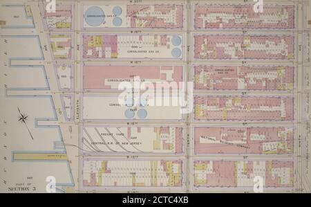 Plaque 6, partie de la section 3 : délimitée par W. 20th Street, Ninth Avenue, W. 14th Street et treizième Avenue, cartographie, Maps, 1899, Bromley, Walter Scott, Bromley, George Washington Banque D'Imageshttps://www.alamyimages.fr/image-license-details/?v=1https://www.alamyimages.fr/plaque-6-partie-de-la-section-3-delimitee-par-w-20th-street-ninth-avenue-w-14th-street-et-treizieme-avenue-cartographie-maps-1899-bromley-walter-scott-bromley-george-washington-image376436771.html
RM2CTC4XB–Plaque 6, partie de la section 3 : délimitée par W. 20th Street, Ninth Avenue, W. 14th Street et treizième Avenue, cartographie, Maps, 1899, Bromley, Walter Scott, Bromley, George Washington
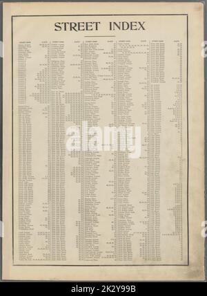 Bromley, George Washington. Cartographie, cartes, atlas, arpentage des terres, cartes d'index. 1907. Lionel Pincus et Princess Firyal Map Division. Brooklyn (New York, New York) , Cartes Street Index. Albany Avenue - 101st Street, vol. 2 Banque D'Imageshttps://www.alamyimages.fr/image-license-details/?v=1https://www.alamyimages.fr/bromley-george-washington-cartographie-cartes-atlas-arpentage-des-terres-cartes-d-index-1907-lionel-pincus-et-princess-firyal-map-division-brooklyn-new-york-new-york-cartes-street-index-albany-avenue-101st-street-vol-2-image483719639.html
RM2K2Y99B–Bromley, George Washington. Cartographie, cartes, atlas, arpentage des terres, cartes d'index. 1907. Lionel Pincus et Princess Firyal Map Division. Brooklyn (New York, New York) , Cartes Street Index. Albany Avenue - 101st Street, vol. 2
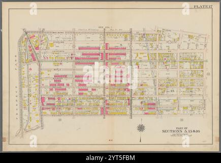 Délimitée par Malbone Street, Kingston Avenue, Winthrop Street, Flatbush Avenue, Parkside Avenue et (Prospect Park) Ocean Avenue, plate 17 1907 par Bromley, George Washington Banque D'Imageshttps://www.alamyimages.fr/image-license-details/?v=1https://www.alamyimages.fr/delimitee-par-malbone-street-kingston-avenue-winthrop-street-flatbush-avenue-parkside-avenue-et-prospect-park-ocean-avenue-plate-17-1907-par-bromley-george-washington-image634446840.html
RM2YT5FBM–Délimitée par Malbone Street, Kingston Avenue, Winthrop Street, Flatbush Avenue, Parkside Avenue et (Prospect Park) Ocean Avenue, plate 17 1907 par Bromley, George Washington
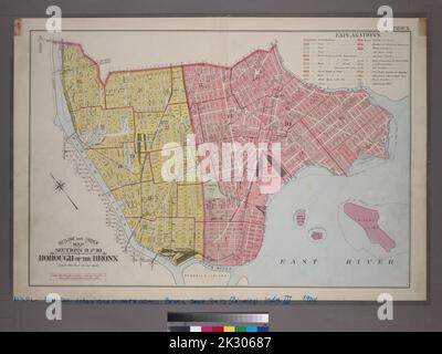 Bromley, George Washington. Cartographie, cartes. 1904. Lionel Pincus et Princess Firyal Map Division. Bronx (New York, N.Y.), immeubles , New York (État) , New York Outline and Index Map, sections 9 et 10, Borough of the Bronx. Banque D'Imageshttps://www.alamyimages.fr/image-license-details/?v=1https://www.alamyimages.fr/bromley-george-washington-cartographie-cartes-1904-lionel-pincus-et-princess-firyal-map-division-bronx-new-york-n-y-immeubles-new-york-etat-new-york-outline-and-index-map-sections-9-et-10-borough-of-the-bronx-image483739207.html
RM2K30687–Bromley, George Washington. Cartographie, cartes. 1904. Lionel Pincus et Princess Firyal Map Division. Bronx (New York, N.Y.), immeubles , New York (État) , New York Outline and Index Map, sections 9 et 10, Borough of the Bronx.