![Bronx, V. B, planche no 13 [carte bornée par 14th Ave., 6th Ave., 5th Ave.] 1897 Banque D'Images Bronx, V. B, planche no 13 [carte bornée par 14th Ave., 6th Ave., 5th Ave.] 1897 Banque D'Images](https://l450v.alamy.com/450vfr/2yp1h1y/bronx-v-b-planche-no-13-carte-bornee-par-14th-ave-6th-ave-5th-ave-1897-2yp1h1y.jpg) Bronx, V. B, planche no 13 [carte bornée par 14th Ave., 6th Ave., 5th Ave.] 1897 Banque D'Imageshttps://www.alamyimages.fr/image-license-details/?v=1https://www.alamyimages.fr/bronx-v-b-planche-no-13-carte-bornee-par-14th-ave-6th-ave-5th-ave-1897-image633131015.html
Bronx, V. B, planche no 13 [carte bornée par 14th Ave., 6th Ave., 5th Ave.] 1897 Banque D'Imageshttps://www.alamyimages.fr/image-license-details/?v=1https://www.alamyimages.fr/bronx-v-b-planche-no-13-carte-bornee-par-14th-ave-6th-ave-5th-ave-1897-image633131015.htmlRM2YP1H1Y–Bronx, V. B, planche no 13 [carte bornée par 14th Ave., 6th Ave., 5th Ave.] 1897
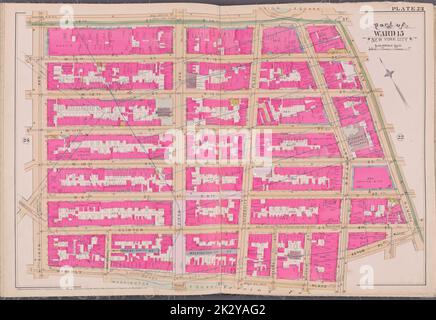 Cartographie, cartes. 1893. Lionel Pincus et Princess Firyal Map Division. New York (New York) Plaque 23 carte délimitée par la rue W. 14th, 4th Ave., Astor PL., Waverly PL., 6th Ave Banque D'Imageshttps://www.alamyimages.fr/image-license-details/?v=1https://www.alamyimages.fr/cartographie-cartes-1893-lionel-pincus-et-princess-firyal-map-division-new-york-new-york-plaque-23-carte-delimitee-par-la-rue-w-14th-4th-ave-astor-pl-waverly-pl-6th-ave-image483720610.html
RM2K2YAG2–Cartographie, cartes. 1893. Lionel Pincus et Princess Firyal Map Division. New York (New York) Plaque 23 carte délimitée par la rue W. 14th, 4th Ave., Astor PL., Waverly PL., 6th Ave
![Manhattan, V. 3, plate No. 27 [Map Bounded by 7th Ave., W. 14th préparé, 6th Ave., W. 11th mis] 1884 - 1936 Banque D'Images Manhattan, V. 3, plate No. 27 [Map Bounded by 7th Ave., W. 14th préparé, 6th Ave., W. 11th mis] 1884 - 1936 Banque D'Images](https://l450v.alamy.com/450vfr/2ypemr8/manhattan-v-3-plate-no-27-map-bounded-by-7th-ave-w-14th-prepare-6th-ave-w-11th-mis-1884-1936-2ypemr8.jpg) Manhattan, V. 3, plate No. 27 [Map Bounded by 7th Ave., W. 14th préparé, 6th Ave., W. 11th mis] 1884 - 1936 Banque D'Imageshttps://www.alamyimages.fr/image-license-details/?v=1https://www.alamyimages.fr/manhattan-v-3-plate-no-27-map-bounded-by-7th-ave-w-14th-prepare-6th-ave-w-11th-mis-1884-1936-image633419340.html
Manhattan, V. 3, plate No. 27 [Map Bounded by 7th Ave., W. 14th préparé, 6th Ave., W. 11th mis] 1884 - 1936 Banque D'Imageshttps://www.alamyimages.fr/image-license-details/?v=1https://www.alamyimages.fr/manhattan-v-3-plate-no-27-map-bounded-by-7th-ave-w-14th-prepare-6th-ave-w-11th-mis-1884-1936-image633419340.htmlRM2YPEMR8–Manhattan, V. 3, plate No. 27 [Map Bounded by 7th Ave., W. 14th préparé, 6th Ave., W. 11th mis] 1884 - 1936
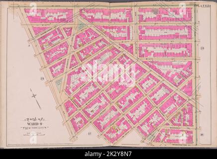 Cartographie, cartes. 1893. Lionel Pincus et Princess Firyal Map Division. New York (New York) Plaque 24 carte délimitée par W. 14th St., 6th Ave., Washington PL., W. 10th St., Hudson St. Banque D'Imageshttps://www.alamyimages.fr/image-license-details/?v=1https://www.alamyimages.fr/cartographie-cartes-1893-lionel-pincus-et-princess-firyal-map-division-new-york-new-york-plaque-24-carte-delimitee-par-w-14th-st-6th-ave-washington-pl-w-10th-st-hudson-st-image483719187.html
RM2K2Y8N7–Cartographie, cartes. 1893. Lionel Pincus et Princess Firyal Map Division. New York (New York) Plaque 24 carte délimitée par W. 14th St., 6th Ave., Washington PL., W. 10th St., Hudson St.
![Manhattan, V. 3, plate No. 20 [Map Bounded by 6th Ave., W. 14th préparé, 5th Ave., W. 11th mis] 1884 - 1936 Banque D'Images Manhattan, V. 3, plate No. 20 [Map Bounded by 6th Ave., W. 14th préparé, 5th Ave., W. 11th mis] 1884 - 1936 Banque D'Images](https://l450v.alamy.com/450vfr/2ypempy/manhattan-v-3-plate-no-20-map-bounded-by-6th-ave-w-14th-prepare-5th-ave-w-11th-mis-1884-1936-2ypempy.jpg) Manhattan, V. 3, plate No. 20 [Map Bounded by 6th Ave., W. 14th préparé, 5th Ave., W. 11th mis] 1884 - 1936 Banque D'Imageshttps://www.alamyimages.fr/image-license-details/?v=1https://www.alamyimages.fr/manhattan-v-3-plate-no-20-map-bounded-by-6th-ave-w-14th-prepare-5th-ave-w-11th-mis-1884-1936-image633419331.html
Manhattan, V. 3, plate No. 20 [Map Bounded by 6th Ave., W. 14th préparé, 5th Ave., W. 11th mis] 1884 - 1936 Banque D'Imageshttps://www.alamyimages.fr/image-license-details/?v=1https://www.alamyimages.fr/manhattan-v-3-plate-no-20-map-bounded-by-6th-ave-w-14th-prepare-5th-ave-w-11th-mis-1884-1936-image633419331.htmlRM2YPEMPY–Manhattan, V. 3, plate No. 20 [Map Bounded by 6th Ave., W. 14th préparé, 5th Ave., W. 11th mis] 1884 - 1936
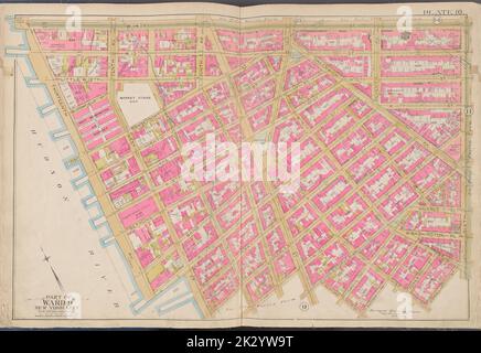 Cartographie, cartes. 1891. Lionel Pincus et Princess Firyal Map Division. Manhattan (New York, N.Y.), immeuble , New York (État) , New York plaque 10 carte délimitée par la rue W. 14th, 6th Ave., rue Bedford, rivière Hudson Banque D'Imageshttps://www.alamyimages.fr/image-license-details/?v=1https://www.alamyimages.fr/cartographie-cartes-1891-lionel-pincus-et-princess-firyal-map-division-manhattan-new-york-n-y-immeuble-new-york-etat-new-york-plaque-10-carte-delimitee-par-la-rue-w-14th-6th-ave-rue-bedford-riviere-hudson-image483732196.html
RM2K2YW9T–Cartographie, cartes. 1891. Lionel Pincus et Princess Firyal Map Division. Manhattan (New York, N.Y.), immeuble , New York (État) , New York plaque 10 carte délimitée par la rue W. 14th, 6th Ave., rue Bedford, rivière Hudson
![Manhattan, V. 3, double page plate No. 58 [Map Bounded by E. 14th réussi, University PL., E. 10th réussi, W. 10th réussi, 6th Ave., W. 14th.] 1895 Banque D'Images Manhattan, V. 3, double page plate No. 58 [Map Bounded by E. 14th réussi, University PL., E. 10th réussi, W. 10th réussi, 6th Ave., W. 14th.] 1895 Banque D'Images](https://l450v.alamy.com/450vfr/2ypen9p/manhattan-v-3-double-page-plate-no-58-map-bounded-by-e-14th-reussi-university-pl-e-10th-reussi-w-10th-reussi-6th-ave-w-14th-1895-2ypen9p.jpg) Manhattan, V. 3, double page plate No. 58 [Map Bounded by E. 14th réussi, University PL., E. 10th réussi, W. 10th réussi, 6th Ave., W. 14th.] 1895 Banque D'Imageshttps://www.alamyimages.fr/image-license-details/?v=1https://www.alamyimages.fr/manhattan-v-3-double-page-plate-no-58-map-bounded-by-e-14th-reussi-university-pl-e-10th-reussi-w-10th-reussi-6th-ave-w-14th-1895-image633419746.html
Manhattan, V. 3, double page plate No. 58 [Map Bounded by E. 14th réussi, University PL., E. 10th réussi, W. 10th réussi, 6th Ave., W. 14th.] 1895 Banque D'Imageshttps://www.alamyimages.fr/image-license-details/?v=1https://www.alamyimages.fr/manhattan-v-3-double-page-plate-no-58-map-bounded-by-e-14th-reussi-university-pl-e-10th-reussi-w-10th-reussi-6th-ave-w-14th-1895-image633419746.htmlRM2YPEN9P–Manhattan, V. 3, double page plate No. 58 [Map Bounded by E. 14th réussi, University PL., E. 10th réussi, W. 10th réussi, 6th Ave., W. 14th.] 1895
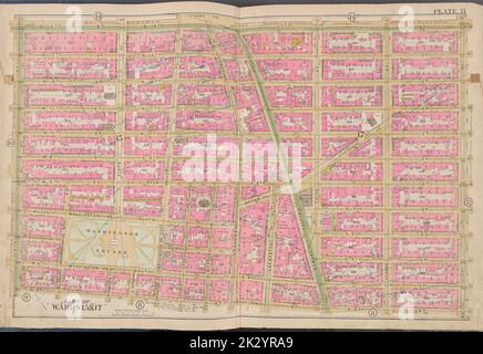 Cartographie, cartes. 1891. Lionel Pincus et Princess Firyal Map Division. Manhattan (New York, N.Y.), immeuble , New York (État) , New York plaque 11 carte délimitée par E. 14th St., 1st Ave., W. 3rd St., 6th Ave Banque D'Imageshttps://www.alamyimages.fr/image-license-details/?v=1https://www.alamyimages.fr/cartographie-cartes-1891-lionel-pincus-et-princess-firyal-map-division-manhattan-new-york-n-y-immeuble-new-york-etat-new-york-plaque-11-carte-delimitee-par-e-14th-st-1st-ave-w-3rd-st-6th-ave-image483730641.html
RM2K2YRA9–Cartographie, cartes. 1891. Lionel Pincus et Princess Firyal Map Division. Manhattan (New York, N.Y.), immeuble , New York (État) , New York plaque 11 carte délimitée par E. 14th St., 1st Ave., W. 3rd St., 6th Ave
![Brooklyn, vol. 1, double page plate No. 25 ; part of Ward 22, section 4 ; [Map Bounded by 8th réunis, 6th Ave., 13th ; include 8th Ave., 16th réunis, 4th Ave.] ; Sub Plan ; [Map Bounded by 8th Ave., 13th équipé ; include 14th assuré, Prospect Park West] 1903 - 1907 by E.B. Hyde & Co. Banque D'Images Brooklyn, vol. 1, double page plate No. 25 ; part of Ward 22, section 4 ; [Map Bounded by 8th réunis, 6th Ave., 13th ; include 8th Ave., 16th réunis, 4th Ave.] ; Sub Plan ; [Map Bounded by 8th Ave., 13th équipé ; include 14th assuré, Prospect Park West] 1903 - 1907 by E.B. Hyde & Co. Banque D'Images](https://l450v.alamy.com/450vfr/2ypyrpb/brooklyn-vol-1-double-page-plate-no-25-part-of-ward-22-section-4-map-bounded-by-8th-reunis-6th-ave-13th-include-8th-ave-16th-reunis-4th-ave-sub-plan-map-bounded-by-8th-ave-13th-equipe-include-14th-assure-prospect-park-west-1903-1907-by-e-b-hyde-co-2ypyrpb.jpg) Brooklyn, vol. 1, double page plate No. 25 ; part of Ward 22, section 4 ; [Map Bounded by 8th réunis, 6th Ave., 13th ; include 8th Ave., 16th réunis, 4th Ave.] ; Sub Plan ; [Map Bounded by 8th Ave., 13th équipé ; include 14th assuré, Prospect Park West] 1903 - 1907 by E.B. Hyde & Co. Banque D'Imageshttps://www.alamyimages.fr/image-license-details/?v=1https://www.alamyimages.fr/brooklyn-vol-1-double-page-plate-no-25-part-of-ward-22-section-4-map-bounded-by-8th-reunis-6th-ave-13th-include-8th-ave-16th-reunis-4th-ave-sub-plan-map-bounded-by-8th-ave-13th-equipe-include-14th-assure-prospect-park-west-1903-1907-by-e-b-hyde-co-image633707043.html
Brooklyn, vol. 1, double page plate No. 25 ; part of Ward 22, section 4 ; [Map Bounded by 8th réunis, 6th Ave., 13th ; include 8th Ave., 16th réunis, 4th Ave.] ; Sub Plan ; [Map Bounded by 8th Ave., 13th équipé ; include 14th assuré, Prospect Park West] 1903 - 1907 by E.B. Hyde & Co. Banque D'Imageshttps://www.alamyimages.fr/image-license-details/?v=1https://www.alamyimages.fr/brooklyn-vol-1-double-page-plate-no-25-part-of-ward-22-section-4-map-bounded-by-8th-reunis-6th-ave-13th-include-8th-ave-16th-reunis-4th-ave-sub-plan-map-bounded-by-8th-ave-13th-equipe-include-14th-assure-prospect-park-west-1903-1907-by-e-b-hyde-co-image633707043.htmlRM2YPYRPB–Brooklyn, vol. 1, double page plate No. 25 ; part of Ward 22, section 4 ; [Map Bounded by 8th réunis, 6th Ave., 13th ; include 8th Ave., 16th réunis, 4th Ave.] ; Sub Plan ; [Map Bounded by 8th Ave., 13th équipé ; include 14th assuré, Prospect Park West] 1903 - 1907 by E.B. Hyde & Co.
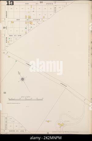 Cartographic, Maps. 1897. Lionel Pincus and Princess Firyal Map Division. Fire insurance , New York (State), Real property , New York (State), Cities & towns , New York (State) Bronx, V. B, Plate No. 13 Map bounded by 14th Ave., 6th Ave., 5th St. Stock Photohttps://www.alamyimages.fr/image-license-details/?v=1https://www.alamy.com/cartographic-maps-1897-lionel-pincus-and-princess-firyal-map-division-fire-insurance-new-york-state-real-property-new-york-state-cities-towns-new-york-state-bronx-v-b-plate-no-13-map-bounded-by-14th-ave-6th-ave-5th-st-image483575756.html
RM2K2MNPM–Cartographic, Maps. 1897. Lionel Pincus and Princess Firyal Map Division. Fire insurance , New York (State), Real property , New York (State), Cities & towns , New York (State) Bronx, V. B, Plate No. 13 Map bounded by 14th Ave., 6th Ave., 5th St.
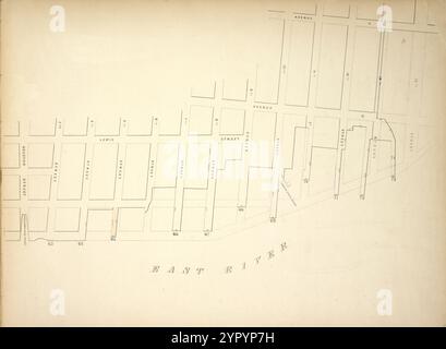 Carte délimitée par Lewis Street, Avenue d, Avenue C, 14th St, Pier - Line 63-73, Houston Street ; y compris Williamsburgh Ferry, 3rd St, 4th St, 5th St, 6th St, 7th St, 8th St, 9th St, 10th St, Green point Ferry, 11th St, 12th St, 13th St 1855 par New York (N.Y.). City Surveyors. Banque D'Imageshttps://www.alamyimages.fr/image-license-details/?v=1https://www.alamyimages.fr/carte-delimitee-par-lewis-street-avenue-d-avenue-c-14th-st-pier-line-63-73-houston-street-y-compris-williamsburgh-ferry-3rd-st-4th-st-5th-st-6th-st-7th-st-8th-st-9th-st-10th-st-green-point-ferry-11th-st-12th-st-13th-st-1855-par-new-york-n-y-city-surveyors-image633705845.html
RM2YPYP7H–Carte délimitée par Lewis Street, Avenue d, Avenue C, 14th St, Pier - Line 63-73, Houston Street ; y compris Williamsburgh Ferry, 3rd St, 4th St, 5th St, 6th St, 7th St, 8th St, 9th St, 10th St, Green point Ferry, 11th St, 12th St, 13th St 1855 par New York (N.Y.). City Surveyors.
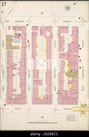 Cartographie, cartes. 1884 - 1936. Lionel Pincus et Princess Firyal Map Division. Assurance incendie , New York (État), immobilier , New York (État), Villes et villages , New York (État) Manhattan, V. 3, plaque no 27 carte délimitée par 7th Ave., W. 14th St., 6th Ave., W. 11th St. Banque D'Imageshttps://www.alamyimages.fr/image-license-details/?v=1https://www.alamyimages.fr/cartographie-cartes-1884-1936-lionel-pincus-et-princess-firyal-map-division-assurance-incendie-new-york-etat-immobilier-new-york-etat-villes-et-villages-new-york-etat-manhattan-v-3-plaque-no-27-carte-delimitee-par-7th-ave-w-14th-st-6th-ave-w-11th-st-image483548028.html
RM2K2KECC–Cartographie, cartes. 1884 - 1936. Lionel Pincus et Princess Firyal Map Division. Assurance incendie , New York (État), immobilier , New York (État), Villes et villages , New York (État) Manhattan, V. 3, plaque no 27 carte délimitée par 7th Ave., W. 14th St., 6th Ave., W. 11th St.
![Manhattan, V. 3, plate No. 28 [Map Bounded by 7th Ave., W. 16th préparé, 6th Ave., W. 14th mis] 1884 - 1936 Banque D'Images Manhattan, V. 3, plate No. 28 [Map Bounded by 7th Ave., W. 16th préparé, 6th Ave., W. 14th mis] 1884 - 1936 Banque D'Images](https://l450v.alamy.com/450vfr/2ypemt7/manhattan-v-3-plate-no-28-map-bounded-by-7th-ave-w-16th-prepare-6th-ave-w-14th-mis-1884-1936-2ypemt7.jpg) Manhattan, V. 3, plate No. 28 [Map Bounded by 7th Ave., W. 16th préparé, 6th Ave., W. 14th mis] 1884 - 1936 Banque D'Imageshttps://www.alamyimages.fr/image-license-details/?v=1https://www.alamyimages.fr/manhattan-v-3-plate-no-28-map-bounded-by-7th-ave-w-16th-prepare-6th-ave-w-14th-mis-1884-1936-image633419367.html
Manhattan, V. 3, plate No. 28 [Map Bounded by 7th Ave., W. 16th préparé, 6th Ave., W. 14th mis] 1884 - 1936 Banque D'Imageshttps://www.alamyimages.fr/image-license-details/?v=1https://www.alamyimages.fr/manhattan-v-3-plate-no-28-map-bounded-by-7th-ave-w-16th-prepare-6th-ave-w-14th-mis-1884-1936-image633419367.htmlRM2YPEMT7–Manhattan, V. 3, plate No. 28 [Map Bounded by 7th Ave., W. 16th préparé, 6th Ave., W. 14th mis] 1884 - 1936