7349 x 6082 px | 62,2 x 51,5 cm | 24,5 x 20,3 inches | 300dpi
Date de la prise de vue:
1827
Lieu:
Canada
Informations supplémentaires:
Cette image peut avoir des imperfections car il s’agit d’une image historique ou de reportage.
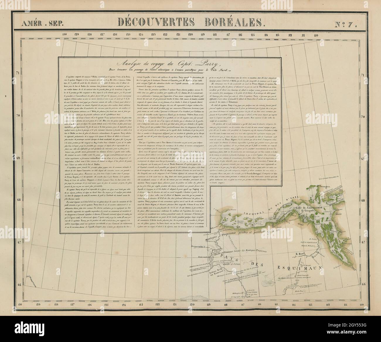
Amér. Sep. - Découvertes Boréales [Analyse du voyage du Capit. Parry] - No. 7. Artist/engraver/cartographer: Philippe Marie Guillaume Vandermaelen. Lithography by Henri Ode. Provenance: "Atlas Universel de Geographie Physique, Politique, Statistique et Mineralogique", dresse par Ph. Vandermaelen - Premiere partie - Europe. Bruxelles. [This landmark atlas is remarkable as the first atlas to have been produced using the then new printing process of lithography. It is also the first atlas to show the whole world in maps using a large uniform scale; in total the 380 conically projected sheets of maps are designed to be joined into a three dimensional terrestrial globe with a diameter of approximately 7.75 metres (25 feet).]. Type: Antique folio-sized lithographic atlas map, hand coloured in outline, on conical projection. This map was published within the first atlas ever to be printed using lithography, and also the first to be printed on a uniform scale. The map shows the Bathurst Inlet, Coronation Gulf, and the Duke of York Archipelago. Inset is an account of the voyage of Captain Parry's 1823-24 Arctic expedition in search of a Northwest Passage