3058 x 4260 px | 25,9 x 36,1 cm | 10,2 x 14,2 inches | 300dpi
Date de la prise de vue:
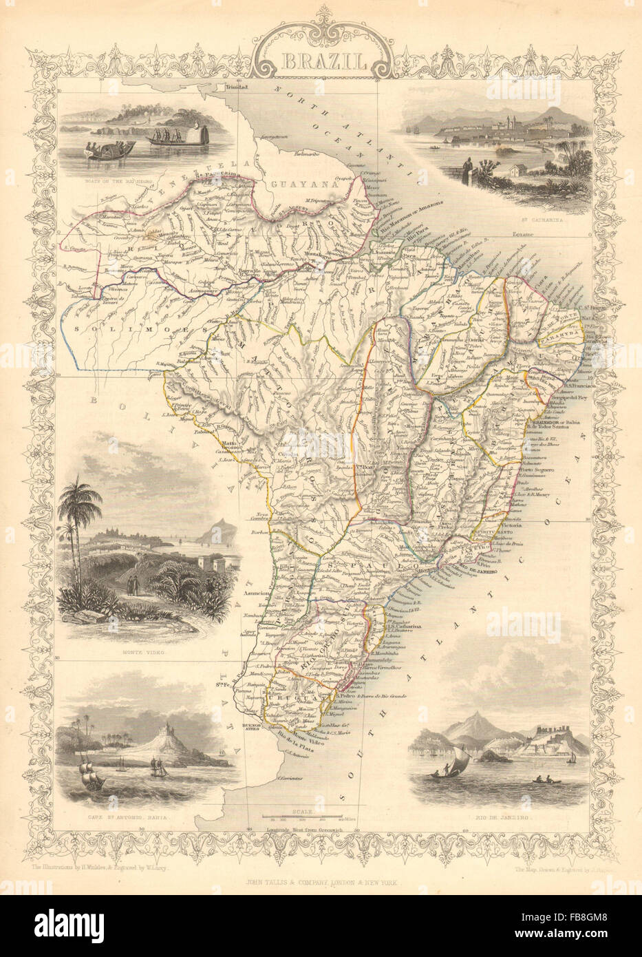
1851
Lieu:
Brazil
Informations supplémentaires:
Cette image peut avoir des imperfections car il s’agit d’une image historique ou de reportage.
Artist/engraver/cartographer: Map drawn and engraved by J. Rapkin; vignette illustrations drawn by H Winkles & engraved by W Lacey. Published by John Tallis & Co. Provenance: "Tallis's Illustrated Atlas and Modern History of the World, Geographical, Political, Commercial and Statistical", edited by R Montgomery Martin Esq., published by John Tallis and Company, London & New York. Type: Antique engraved map by J Rapkin, published by John Tallis. Original outline hand colour, decorative border, and attractive inset vignette views. The map shows Uruguay as a state or province of Brazil. An Argentine backed force had laid siege to Montevideo some years earlier, a siege which was relieved by a Brazilian intervention in May 1851, the year of publication of this map. Montevideo rewarded Brazil's support by signing treaties that confirmed Brazil's right to intervene in Uruguay's internal affairs. Vignettes: Boats on the Rio Negro; St. Catharina; Monte Video; Cape St. Antonio - Bahia; Rio De Janeiro