8053 x 6087 px | 68,2 x 51,5 cm | 26,8 x 20,3 inches | 300dpi
Date de la prise de vue:
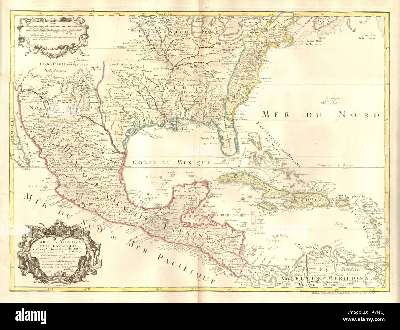
1745
Lieu:
North America
Informations supplémentaires:
Cette image peut avoir des imperfections car il s’agit d’une image historique ou de reportage.
Artist/engraver/cartographer: Guillaume de l'Isle. Provenance: The map was extracted from a composite atlas of early 18th century maps, the latest of which was dated c1754. Type: Large antique 18th century atlas map, printed on thick, good quality paper with original hand colour/color and decorative title & scale cartouches. This early map of North America shows it divided into colonies of Spain (red), France (blue) and Great Britain (yellow), with the then British territories forming a precariously thin sliver along the Atlantic seaboard. La Salle's French colony in present-day Texas, which had failed a few years prior to the publication of the map, is marked as "Fort François" (French fort). The French fort of Fort Louis de la Louisiana is shown at the mouth of the Mobile River; a village (commonly called "La Mobile") was laid out in a grid pattern behind the fort. Numerous towns are named in New England and the British colonies, including St Augustine, Port Royal, "N[ew] York or Manate" (a distortion of Manhattan), Charleston, Salem, Boston, Philadelphia, New Plymouth.